
Blumaps
Blumaps
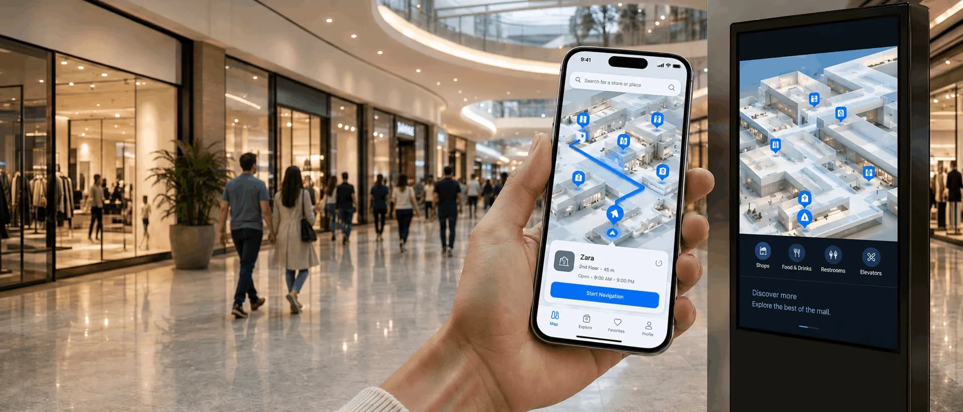
Indoor digital map to guide visitors in large spaces
Routes, points of interest, QR Codes, kiosks, multilingual support, contextual information, and usage data for airports, shopping malls, events, and complex environments.
Blumaps
What Blumaps is
Routes, points of interest, QR Codes, kiosks, multilingual support, contextual information, and usage data for airports, shopping malls, events, and complex environments.
When to use
When Blumaps usually fits best
Situations where the product tends to make sense inside complex physical operations.
Operational fit
In complex environments, visitors get lost, self-service becomes fragmented and operations lose visibility over flow.
Core value
Indoor digital map to guide visitors in large spaces
What it delivers
Routes, points of interest, QR Codes, kiosks, multilingual support, contextual information, and usage data for airports, shopping malls, events, and complex environments.
Problems
Problems that Blumaps helps address
Visitors get lost and depend on human assistance
Critical information is spread across different channels
Difficulty finding gates, stores, services and internal areas
Low continuity between kiosk and mobile
Lack of information standardization
Dependence on in-person assistance
Applications
Main capabilities
Wayfinding e rotas
POIs and categories
QR codes and kiosk-to-mobile continuity (when applicable)
Usage analytics (when applicable)
How it works
How Blumaps works in practice
A practical view of the setup, rollout and operating path.
Phase 1
Environment modeling (floor plans, POIs and routes)
Phase 2
Map publishing across web, mobile and kiosks
Phase 3
Wayfinding and routes to services and points of interest
Phase 4
Usage instrumentation and analytics
Phase 5
Continuous evolution based on data
Capabilities and notes
Key capabilities, integrations and delivery notes
Wayfinding e rotas
POIs and categories
QR codes and kiosk-to-mobile continuity (when applicable)
Usage analytics (when applicable)
Customer CMS, directories and services (when applicable)
Maps and cartographic base (when applicable)
Validation and access control according to project needs
No public exposure of sensitive architecture details
Recommended industries
Where Blumaps is usually applied
Airports
Shopping Centers
Trade Shows and Events
Logistics Centers
Complementary products
Products that pair well with Blumaps
Possible product combinations inside the Blucom portfolio according to the challenge and environment.


Indoor positioning with AI
BPS — Blumaps Position System
More reliable indoor positioning in environments where GPS cannot respond well.
In many indoor environments, such as shopping malls, airports, hospitals, industrial facilities, business centers and underground areas, GPS signals can be weak, unstable or unavailable. When the user’s starting position is not identified correctly, indoor navigation becomes less accurate and route generation is limited.
BPS is Blucom’s proprietary technology that enables Blumaps to estimate a person’s location in these environments without relying on traditional GPS. To make this possible, Blucom maps and georeferences the site and trains a proprietary AI to recognize internal references within the space.
Indoor positioning for complex and covered environments
Proprietary AI trained from the real environment
Greater reliability in identifying the user’s starting point
Better experience when starting indoor routes in Blumaps
The problem it solves
In indoor or underground environments, traditional GPS may fail to identify the user’s position correctly, compromising navigation and route definition from origin to destination.
How BPS works
Blucom maps and georeferences the location and trains a proprietary AI to recognize internal references in the environment and estimate the user’s position.
What Blumaps gains
With BPS, Blumaps can start indoor routes more reliably, even in covered, complex or low-signal environments.
A proprietary technology foundation developed by Blucom to expand the effectiveness of indoor navigation.
Related application
Related context
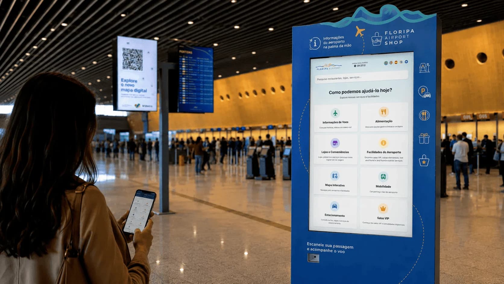
Bluhub Floripa Airport
At Floripa Airport, Blucom evolved the initial digital map into a complete passenger information hub available on kiosks and mobile devices, bringing together flights, indoor maps, routes, directories, services, boarding guidance, useful content and WhatsApp messaging.
Bluhub works as a digital layer for guidance, information and self-service in high-traffic physical environments. At Floripa Airport, it combines kiosk interfaces, mobile experience, indoor map and content modules to support passengers before, during and after their time in the terminal.
Internal links
Explore more
FAQ
Common questions about Blumaps
Want to evaluate Blumaps for your operation?
Talk to Blucom to review whether this product fits your environment, challenge and current infrastructure.